Exploring how glaciation has shaped the coastline of north Norfolk and the land bridge that once connected the UK with mainland Europe.
Video
LIZ BONNIN: Hi, I’m Liz Bonnin. Now Britain is, of course, an island and always has been, right? Well, no. During the most recent major ice age - which only really ended around 11,000 years ago - glaciation meant that lots of the Earth’s water froze, expanding the ice sheets and exposing huge areas that were normally covered by sea. It meant that it was possible to walk from here to Northern Europe, and on the way you might encounter a rhino or a hippo.
To find out more, here’s Alice Roberts visiting Cromer, on the north Norfolk coast…
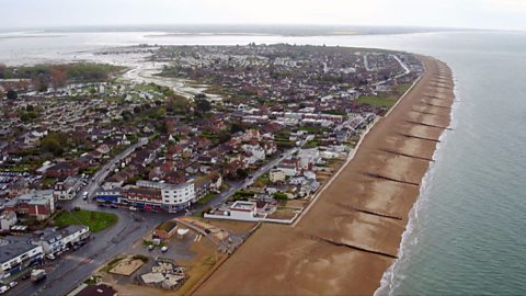
ALICE ROBERTS: The north Norfolk coastline is very distinctive, the way it sort of bulges out into the North Sea, and it’s along this coastline that we find evidence for how and when Britain became an island, and actually very excitingly, when that was.
For the answer, we have to go back in time to what we broadly call the ice age. For 700,000 years, massive ice sheets, up to a mile thick, have come and gone across Britain, moving slowly down from Scotland and carving the landmass as they travelled.
Along the way they swept up rocks, crunching them up as they slipped southwards. At one point, the ice sheets began to melt as they approached the north Norfolk coast, and even today we can still see evidence in the landscape.
What I’m really interested in are the hills in the distance over there because whereas most of Norfolk is of course flat, those hills are particularly interesting because they were formed by the edge of the ice sheet.
All the crumbled rock it carried within it was dumped in a long line at the point where the ice melted.
All of these hills are what’s left behind.
But these hefty ice sheets did much more than carve mountains and create hillsides. They changed the position of the entire East coastline.
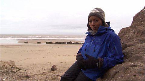
Evidence for the transformation lies under the waters of North Sea. Core samples taken from the floor of the sea reveal how the last ice age completely changed the shape of Britain.
PETER BALSON: We can see this dark brown peat layer, which was deposited in a marsh environment which existed in this area between about 11,000 and 9,000 years ago.
ALICE ROBERTS: Right. Hang on a minute, because you’re saying this is a marsh environment. It’s peat, so it’s fresh water, but this is water that’s now underneath the North Sea?
PETER BALSON: Yes, so in fact this core was taken from about 35m water depth in the North Sea.
ALICE ROBERTS: Peat can only be formed on land in freshwater marshes. Finding this peat layer proves that the North Sea must once have been dry land. Carbon dating suggests the peat is around 11,000 years old, from the tail-end of the last ice age.
Why was the sea level so low at that point?
PETER BALSON: During the maximum period of glaciation, global sea level might have been up to 120m below the present day. That’s because of the amount of water that’s been locked away inside these ice caps.
ALICE ROBERTS: How extensive was this area of exposed land?
PETER BALSON: This area of land at this time was very extensive in the southern North Sea. The area we’re talking about stretches from right the way across north Norfolk to Holland. And all of this area here would have been this sort of lowland marshy area that you could imagine that animals and human beings could have crossed this area, and that’s why it’s known as a land bridge.
ALICE ROBERTS: So we were joined to mainland Europe by a temporary bridge of land, that would have come and gone with changes in climate. And it’s all still there under the North Sea. Deep freeze cold-snaps have happened many times over the last 700,000 years.
During each cold period, water was locked up as ice, causing sea levels to fall and exposing new areas of land that connected us to Europe.
Animal bones dredged up from the North Sea reveal a lost world we wouldn’t recognise today.
At Gressenhall Museum, there’s a vast repository of these exotic animal bones.
NIGEL LARKIN: This is a rhino skull that was dredged off the coast of Yarmouth, about 100 years ago I believe. This was our indigenous fauna during the ice ages. We had woolly rhino, woolly mammoth, reindeer - not so exotic.
ALICE ROBERTS: Yeah.
NIGEL LARKIN: But at other times, during warmer periods, we did have much more exotic sounding creatures. We had things like hippos that lived here during the warmer period. During which time we hardly had any land bridge at all. And then, after that, there came the ice ages again and they became extinct locally.
ALICE ROBERTS: The evidence from under the sea proves there was a land bridge, which allowed animals and our ancestors to walk back into Britain after the coldest periods of the last ice age.
A few more thousand years of melting ice and rising sea levels, and the land bridge disappeared under the sea. And we began our adventure as an island people.
LIZ BONNIN: And if you’re not sure what the peat is that Alice referred to in that clip, it’s basically plant matter that has decomposed in wet areas - like marshes and bogs - and over time has turned into a thick, muddy substance. This is incredibly important habitat for lots of wildlife and it helps to keep our planet healthy.
Download/print a transcript of the video.
Liz Bonnin introduces a clip exploring how the Ice Age has shaped sections of the UK coastline.
Alice Roberts visits Cromer on the North Norfolk coast to examine the evidence for physical processes shaping the UK. An animation reveals how much of UK was once covered in ice and how the landscape was shaped by their movement. The film explains how hills along the coastline are formed from material left behind from the ice sheet.
The film explains why global sea levels were so low during the last Ice Age, before visiting a collection of animal bones that provide the evidence for the land bridge that once existed between what is now the UK and continental Europe.
Teacher notes
Download/print the Teacher Notes for this episode (pdf).
Before watching the video
Look at maps which show the extent of the ice sheets from 11,000 years ago. Ask students to describe the area covered in ice and how far south the ice sheet covers.
Ask students to predict what the UK and Europe would have looked like at this this time.
Introduce key terms such as:
Glaciation: The process by which glaciers shape the landscape.
Ice sheet: A mass of glacial land ice which extends more than 50,000 square kilometres.
Peat: A type of soil that consists of partially decomposed organic matter, which is derived mostly from plant material.
Core samples: Samples taken from below the ground which can be examined to tell us about the past.
Deposition: The laying down of sediment carried by wind, flowing water, the sea or ice.
During the video
You may wish to stop at relevant points during this short film to pose questions and check understanding or wait until the end.
Useful questions might include:
- When did the last major ice age end?
- How thick were the ice sheets?
- What is peat?
- Where does peat form?
- What were sea levels like at the maximum period of glaciation?
- What could be found between north Norfolk and Holland?
- What types of animal bones were found? Are these animals found in the UK now?
- Is the land bridge still there today? What has changed?
After watching
Ask students whether their predictions on what the UK looked like 11,000 years ago was correct. Discuss with students if there was anything in the clip that surprised them, for example finding rhino and hippo remains. Look back at the maps of the UK and Europe 11,000 years ago and look for the land bridge and the change in sea levels. Using websites such as Antarctic Glaciers show students maps of the extent of the ice sheets.
Discuss with students ‘Doggerland’ and evidence for its existence and why we can no longer see this piece of land. This is a good opportunity to introduce isostatic and eustatic sea level change and look at some of the landforms that can be created due to the changes in sea levels.
Look at maps of where there are areas of ice today. Do we still have evidence of ice in the UK? Discuss with students what patterns they can see in the extent of ice today. Students could then create maps to show the ice sheets 11,0000 years ago and areas of ice today.
Where next?
Submergent and emergent landforms created by the changes in sea level can be seen in the UK. Research the different landforms found in the UK such as raised beaches and rias.
Find images of the different landforms and where they are found in the UK.
Research their formation and draw step-by-step diagrams to explain their formation.
Curriculum notes
This topic appears in Geography at KS3 (Glaciation) and KS4 / GCSE (Glaciation) in England, Wales and Northern Ireland and National 4/5 in Scotland.
More videos from this series
What is the water cycle? video
Iain Stewart describes the water cycle including evaporation, condensation and precipitation.
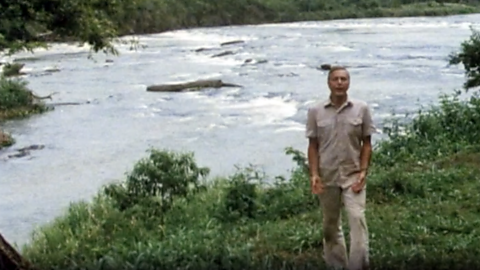
How does a river change as it travels downstream? video
An archive clip of Sir David Attenborough as he follows the course of the Amazon River as it travels downstream.
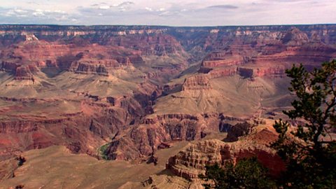
The erosion of the Grand Canyon. video
Liz Bonnin introduces the Grand Canyon - its ancient geology and what can be learned from the erosion of the rocks.
What coastal management techniques are being used on Hayling Island? video
Introduces the coastal management techniques used on Hayling Island in Hampshire to control drift and flooding.
What is a ‘spit’ and how does it form through longshore drift? video
Katie Knapman explains how a spit forms through longshore drift and is a dynamic physical process, constantly changing the coastline.
The geology of the Jurassic Coast. video
Exploring the Jurassic coastline and its geological significance with rocks spanning the Cretaceous, Jurassic and Triassic periods.
How have physical processes impacted the landscape of Yorkshire? video
Julia Bradbury explains the formation of Malham Cove including limestone pavement, highlighting the impact of glaciers on the landscape.
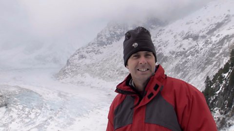
How has glaciation shaped the landforms of the Northern Hemisphere? video
Iain Stewart explains the glaciation of the Northern Hemisphere, focusing on the Yosemite Valley in California.
What evidence is there for climate change in the UK? video
Tom Heap considers the evidence that the UK climate might be changing - with more droughts, higher summer temperatures, but wetter winters.
How can plate tectonics impact oceans? video
Exploring how the plate tectonics impacts the coastline, focusing on California through study of the San Andreas fault.
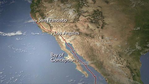
Plate tectonics in the UK - Anglesey. video
Nick Crane explores the geology and seismology of Anglesey - earthquake hot spot of the UK.
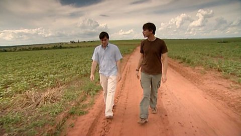
Deforestation and the growth of soya in Paraguay. video
Simon Reeves visits Paraguay to consider the deforestation that has occurred there to grow soy and the challenge of conservation vs development.